


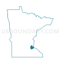
Farmington P-2, Dakota County, Minnesota
About
Outline

Summary
| Unique Area Identifier | 601742 |
| Name | Farmington P-2 |
| County | Dakota County |
| State | Minnesota |
| Area (square miles) | 1.77 |
| Land Area (square miles) | 1.72 |
| Water Area (square miles) | 0.05 |
| % of Land Area | 97.25 |
| % of Water Area | 2.75 |
| Latitude of the Internal Point | 44.63496990 |
| Longtitude of the Internal Point | -93.12954460 |
Maps


Graphs
Select a template below for downloading or customizing gragh for Farmington P-2, Dakota County, Minnesota


Neighbors
Neighoring Voting District (by Name) Neighboring Voting District on the Map
- Castle Rock Twp. Voting District, Dakota County, MN
- Empire Twp. Voting District, Dakota County, MN
- Farmington P-1, Dakota County, MN
Top 10 Neighboring County Subdivision (by Population) Neighboring County Subdivision on the Map
- Farmington city, Dakota County, MN (21,086)
- Empire township, Dakota County, MN (2,444)
- Castle Rock township, Dakota County, MN (1,342)